MIAMI – Hurricane Helene is expected to slam into Florida’s Big Bend coast on Thursday, prompting a series of watches and warnings across the state as forecasters expect the storm to unleash life-threatening conditions.
All of South Florida and the Florida Keys were under a tropical storm warning Wednesday as Helene made its way on a path that will likely see it move north through the Gulf of Mexico ahead of landfall Thursday evening.
The storm is forecast to bring “life-threatening storm surge, damaging winds and flooding rains to a large portion of Florida and the southeastern United States,” the National Hurricane Center says.
The storm is expected to intensify as it approaches Florida’s Gulf Coast.
“Helene has a high chance of undergoing a period of rapid intensification as it moves into the Gulf of Mexico,” said NEXT Weather meteorologist KC Sherman. “The environment will feature low wind shear and warm sea-surface temperatures, which will allow for quick strengthening.”
Sherman said the storm is forecast to make landfall as a Category 3 hurricane, but a Category 4 storm is possible.
“Regardless, life threatening storm surge will remain a significant threat for the Big Bend of Florida all the way down the west coast of Florida,” she said.
A hurricane warning is in effect from Anclote River, near Tarpon Springs, to Mexico Beach in the state’s panhandle. A hurricane watch is in effect from Englewood to Anclote River, including Tampa Bay.
A tropical storm warning has been issued for the state’s west coast from Flamingo, in the Everglades to the Anclote River, including Tampa Bay, west of Mexico Beach to the Walton/Bay county line. The state’s east coast is also under a tropical storm warning from Flamingo north to the South Santee River in South Carolina.
“Helene will remain a very large and growing storm, with the wind field expected to span over 400 miles at it’s largest point,” Sherman said. “So it is important to remember that while center is projected to make landfall along the Big Bend, significant impacts will be felt up and down the west coast of Florida extending well outside of the center.”
The hurricane center’s forecast cone shows Helene moving north in the panhandle Thursday night. Tallahassee is in the center of the forecast path. From there it is forecast to pass into Alabama and Georgia.
“Dangerous” storm surge,” flooding risks
Storm surge on Florida’s Gulf Coast could reach 10 to 15 feet near where the storm makes landfall, according to the National Hurricane Center. Tampa Bay and the area from the Anclote River to the middle of Longboat Key could see 5 to 8 feet of storm surge. Charlotte Harbor could see 3 to 5 feet.
According to the National Hurricane Center, Helene is expected to produce 5 to 10 inches of rain over the southeastern U.S.
“This rainfall will likely result in areas of considerable flash and urban flooding, with areas of significant river flooding. Landslides are possible in areas of steep terrain in the southern Appalachians,” according to the hurricane center.
Tornados could also be seen in parts of the Florida Peninsula and southern Alabama, the hurricane center said.
“The risk of tornadoes will increase on Thursday, expanding northward across Florida into parts of Georgia and South Carolina,” it said.
South Florida forecast
While South Florida will not be in the storm’s direct path, the region will feel impacts.
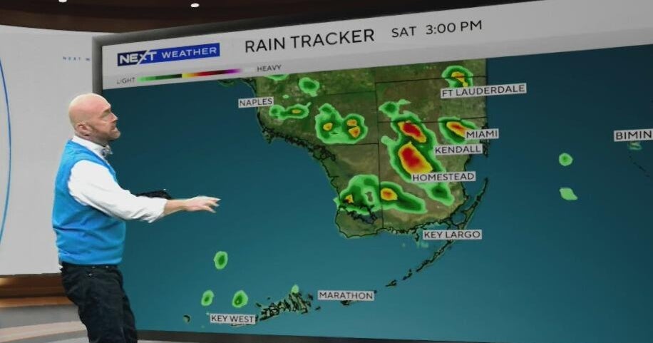
The tri-county area will start to feel the fringe impacts Wednesday as gusty, tropical bands of rain move through. Wind gusts are forecast to be up to 30 mph.
Thursday afternoon will be even windier, with gusts up to 50 mph forecast for Miami-Dade and Broward Counties, and up to 60 mph in the Keys.
Bands of heavy rain will continue through Friday. Approximately 2 to 4 inches of rain are expected. There may be some locally heavier spots, particularly in areas that receive “training” rain bands that move over the same area for a prolonged period of time.
Saltwater flooding from storm surge will only be a threat in the Keys, where 1 to 3 feet of storm surge will be possible at high tide through Thursday. A coastal flood warning has been issued for the Keys.
Cities, residents prepare
Gov. DeSantis has declared a state of emergency in 61 of Florida’s 67 counties. President Joe Biden approved Florida’s emergency declaration, ordering the Federal Emergency Management Agency to coordinate all disaster relief efforts. It includes assistance and reimbursement for mass care including evacuation and shelter support.
Federal authorities have positioned generators, food and water, along with search-and-rescue teams.
DeSantis’ order also activated the Florida National Guard and Florida State Guard to assist in the storm’s aftermath. About 18,000 utility line workers are being pre-positioned to help restore power when conditions are safe to do so.
The governor said Wednesday that 12 health care facilities have evacuated. He urged people to prepare immediately.
Several counties on Florida’s west and northwestern coasts have issued evacuation orders, and schools planned to close or reduce hours.
In Tampa, a mandatory evacuation order was issued at the University of Tampa. Other universities have been impacted, including the University of Florida, which canceled classes for Thursday.
Several cities across South Florida took a proactive stance to help their residents. The City of Hollywood is managing water levels, with a backup plan to redirect excess water, and Miami is clearing storm drains to prevent flooding.
“It’s obvious that there are some debris that keeps falling into there, and that’s what we do just to clean it up. And it is extremely important so that then the water can flow and avoid those big floodings that we have seen in the past,” said Miami’s director of communications Kenia Fallat.
Additionally, sandbags are being made available for free in select cities. Hollywood, Dania Beach and Fort Lauderdale are offering free sandbags to residents.
Hollywood and Miami Beach are also allowing residents to park in public garages for free if they’re concerned about flooding.
All schools and school district offices in the Keys will be closed on Thursday.


