
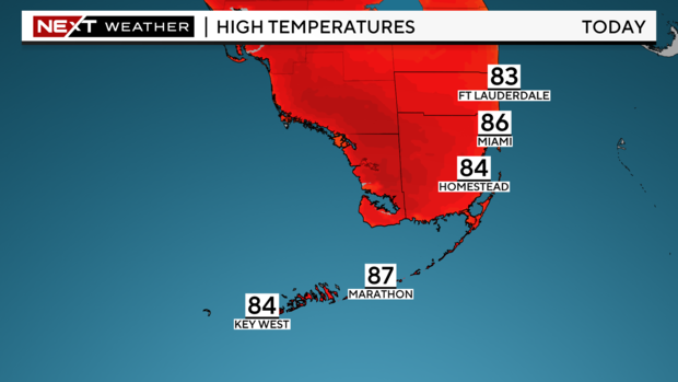
MIAMI – It was mainly dry and mild Wednesday morning with temperatures in the low to mid-70s.
NEXT Weather
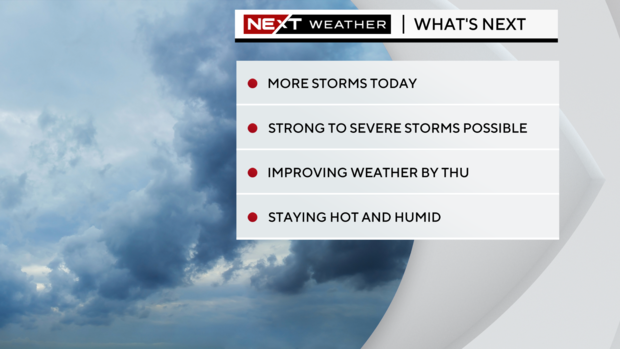
The National Weather Service issued a severe thunderstorm watch for Miami-Dade and Broward counties that lasts until 9 p.m.
The National Weather Service’s Storm Prediction Center has placed Broward and Miami-Dade under a slight risk of strong to severe storms with the potential for heavy rain, flooding, damaging winds, and frequent lightning. There is a low-end chance for small hail and an isolated chance of a brief tornado.
NEXT Weather
The storm chance is high due to an active southern jet stream that will continue to foster a favorable environment for storms to develop. From noon until 6 p.m. is when we will likely see storms develop, however scattered storms may linger through the evening until around midnight.
The rain chance decreases Thursday into Friday as the storm track lifts to the north. But spotty storms will still be possible. Highs will warm to the upper 80s.
Mother Nature turns up the heat with highs near 90 degrees this weekend. Saturday and Sunday scattered storms likely develop in the afternoons.

Thanks for reading CBS NEWS.
Create your free account or log in
for more features.


