
It was a wet and stormy weekend across South Florida, and it’s looking like that trend will continue as we kick off the new workweek.
CBS News Miami
Another round of scattered showers and thunderstorms will move into South Florida on Monday, and the region is under a marginal risk (Level 1) of severe weather due to the threats of storms capable of producing damaging wind gusts and small hail.
CBS News Miami 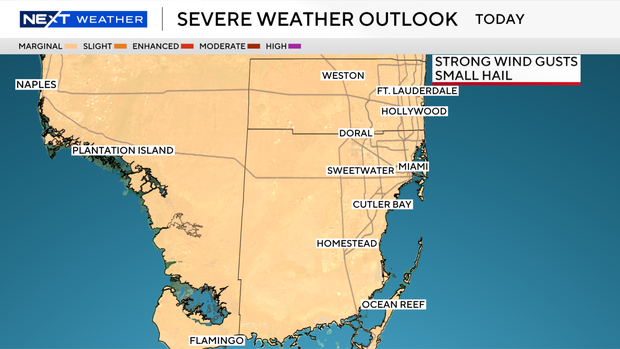
Heavy downpours and localized flooding will also be possible.
The first wave of weather will move in later on Monday morning through midday and into the afternoon hours.
More widespread storms are likely later Monday night and overnight as a cold front pushes through.
And heads up for spring breakers in South Florida – there’s a dangerous risk of rip currents along the Atlantic beaches. It’s not safe to go swimming in the ocean.
And a small craft advisory is in effect for the Atlantic and Keys waters. Either way, Monday won’t be the best day to head to the beach or go boating due to the scattered storms expected and the clouds around.
CBS News Miami 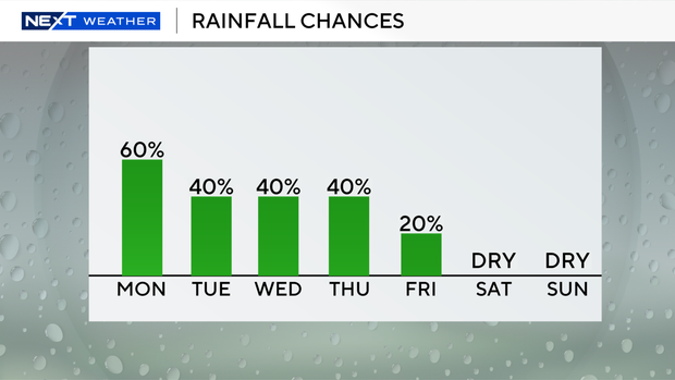
We will stay unsettled due to lingering moisture on Tuesday, but the rain chances will be lower. Passing showers will be possible, but they aren’t expected to be as intense or numerous as Monday.
It will be cooler with the upper 60s in the morning and high temperatures close to the mid-70s in the afternoon for St. Patrick’s Day.
CBS News Miami 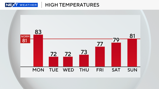
Temperatures will then tumble into the 60s on Wednesday and Thursday morning with high temperatures in the low 70s. Spotty showers will be possible, but the chance of rain will be decreasing.
We will officially kick off spring with the vernal equinox taking place on Friday, and we’ll warm up this weekend as high temperatures will rise into the upper 70s and low 80s under mostly sunny skies.
CBS News Miami 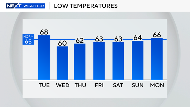
It’s expected to be drier on Saturday and Sunday.


