Some showers moved across parts of the Keys this Tuesday morning. Broward and Miami-Dade started dry.
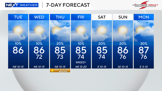
The chance of rain stays low, with only stray showers possible later Tuesday. Highs will climb to the mid-to-upper 80s in the afternoon under mostly sunny skies. It will be mostly dry and breezy, as winds gust 15 to 20 mph or stronger.
A coastal flood statement is in effect through Tuesday afternoon, as isolated minor coastal flooding will be possible over low-lying areas.
There is a high risk of rip currents along the Atlantic beaches. It is not safe to go swimming in the ocean. There are no alerts for boaters over the Atlantic waters, but there is a moderate chop on the bays.
Small craft should exercise caution over the Keys as winds increase out of the northeast 15 to 20 knots and conditions turn choppy nearshore.
The chance of rain stays low on Wednesday, with only a few showers possible. It will be a comfortable start, with low to mid-70s in the morning. Highs rise to the mid-to-upper 80s in the afternoon.
An uptick in moisture associated with a weak frontal boundary will lead to spotty showers Thursday. Highs will remain in the mid-to-upper 80s.
It will be drier and breezy Friday, before the rain chance rises this weekend. It will not be a washout, but passing showers will be possible Saturday and Sunday.