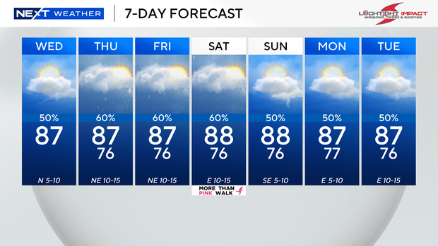
Rain makes a comeback as October begins. While the day starts dry and sunny, some showers and storms will form later.
High temperatures will reach the upper 80s Wednesday afternoon. It will feel like the mid to upper 90s once humidity is factored in.
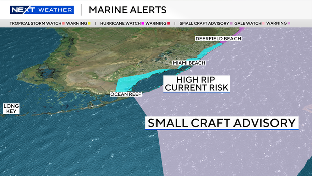
As Hurricane Imelda continues to pull away from the U.S. coast, elevated wave heights and strong rip currents will lead to hazardous surf and swimming conditions along the east coast. The risk of rip currents along the Atlantic beaches remains high through late Saturday night. It is not safe to go swimming.
A small craft advisory is in effect for boaters along the Atlantic waters due to 7 to 10-foot seas and northeast winds of 10 to 15 knots.
As moisture moves in and winds shift out of the east, the chance of rain rises late week, with scattered storms Thursday and Friday.
The Weather Prediction Center has placed Broward and Miami-Dade under a level 1 risk of excessive rainfall and flash flooding Thursday as storms roll through the area. With more cloud coverage and wet weather around, highs will stay in the upper 80s.
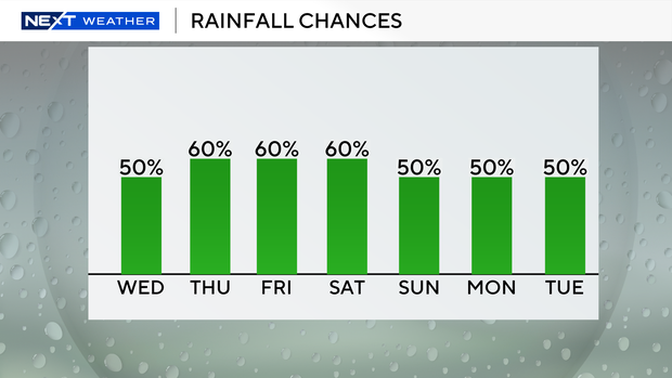
This weekend, the weather pattern stays unsettled with deep moisture in place. The chance of rain stays high with the potential for daily scattered storms. Highs will remain seasonable in the upper 80s on Saturday and Sunday.