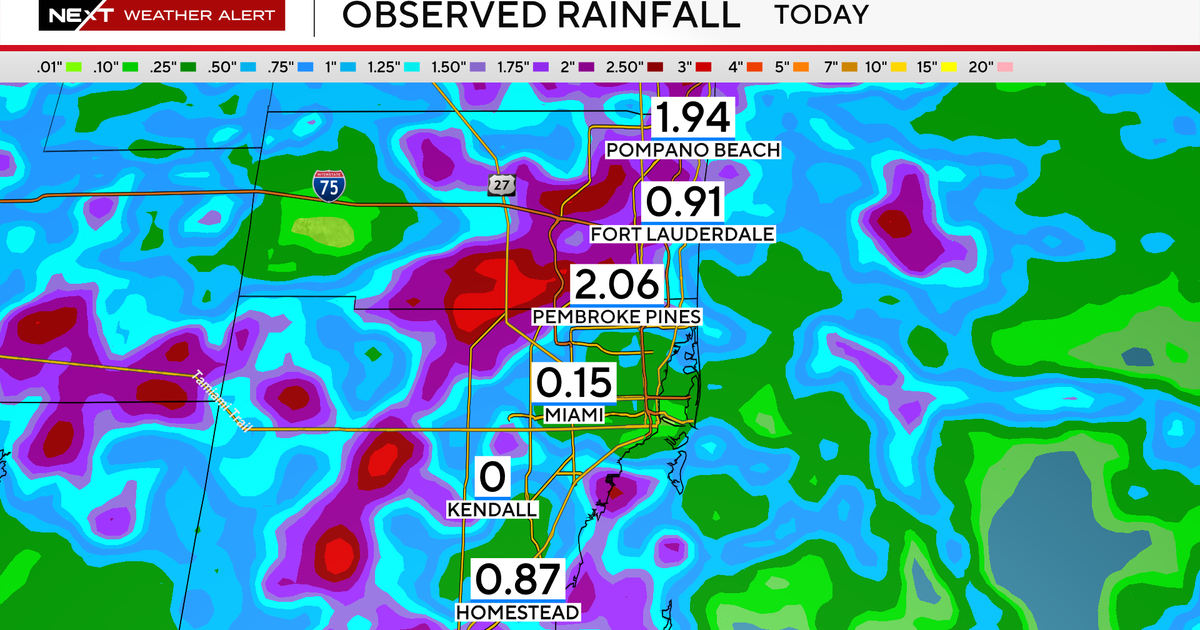
The threat of significant flooding across South Florida has passed for now, as rainfall totals on Monday came in within forecasted expectations.
The NEXT Weather team had previously issued Weather Alert Days for both Monday and Tuesday due to the potential for flash flooding, citing a Level 2 out of 4 excessive rainfall risk issued by the Weather Prediction Center (WPC).
However, as storms failed to “pin” along the coastline—a meteorological process that can rapidly produce several inches of rain in a short period—the worst-case scenarios did not develop.
“Since we didn’t get widespread flooding along with a drying trend in the models, an Alert Day may not be necessary tomorrow,” the NEXT Weather team said in an update.
Forecast totals hold
Rainfall amounts largely matched Monday’s forecast of 1 to 3 inches across the region, though earlier projections warned of isolated areas potentially receiving up to 7 inches.
A flood watch was in effect Monday afternoon and evening, but no major flooding materialized.
“The potential of significant flooding was there today but storms did not ‘pin’ along the coastline, a process that can easily wring out several inches in a short amount of time,” the update noted.
Currently, there are no active flood alerts in South Florida.
System moves west, watching the Gulf
As the trough of low pressure that brought Monday’s rains moves west across the peninsula and into the Gulf, the risk of flooding in South Florida diminishes.
The National Hurricane Center is monitoring the system for possible tropical development later this week, though chances remain low.
The NEXT Weather team will continue monitoring the system’s movement and any possible impacts to the region in the coming days.


