
It was a mild and breezy start to Friday with temperatures in the low to mid-70s and winds gusting up to 30 mph. While a few stray showers are possible throughout the day, most areas will remain dry to close out the workweek.
The windy conditions will continue throughout the afternoon. This will create a high rip current risk and high surf heights at our beaches, and rough marine conditions. A small craft advisory is in effect for the Atlantic and Florida Keys waters.
Afternoon highs will be in the upper 70s and low 80s.
Our chances of rain will rise over the weekend as a disturbance moves in from the Gulf.
NEXT Weather
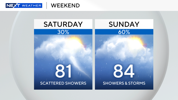
On Saturday, there is a 30% chance for scattered showers and storms, mostly in the afternoon. The best chances for showers and storms will be on Sunday afternoon, about a 60% chance, around the peak heating of the day. While the weekend will not be a washout, it’s best to keep the rain gear nearby.
Looking ahead to next week, there may be a few isolated showers and afternoon highs will climb into the mid 80s. Our humidity is expected to increase, so “feels like” temperatures will be closer to 90 degrees.


