
The NEXT Weather Team has issued a NEXT Weather Alert in effect for Tuesday due to the potential for flooding in the metro areas for Broward and Miami-Dade counties.
CBS News Miami
The flood watch is in effect until 10 p.m. Tuesday due to the potential for flooding from heavy downpours.
CBS News Miami 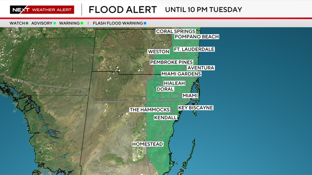
Widespread rain totals could range from 1-3 inches with isolated totals up to 6 inches.
Multiple rounds of rain are in the forecast for Tuesday with widespread showers and storms that started before sunrise and lasted through around 10 a.m.
CBS News Miami 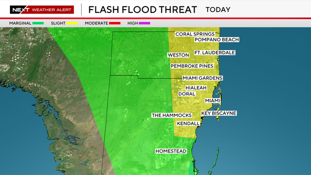
This led to a tricky morning commute and drop off for school.
A break in the rain arrived for midday, but another round of showers and thunderstorms is expected to develop Tuesday afternoon into the evening.
Heavy downpours along with saturated ground from morning showers could lead to flooding in poor drainage areas along with urban areas.
CBS News Miami 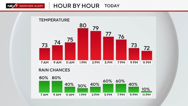
More rain is on the way for Wednesday as a minor flood risk will continue across the metro areas of Broward and Miami-Dade counties.
Drier air begins to arrive for the back half of the workweek and weekend.
Breezier conditions return on Wednesday and will create hazardous conditions at the coast, including a high rip current risk for beachgoers and small craft advisories for boaters.
Afternoon high temperatures will peak around 80 degrees for Tuesday, the rest of the workweek, and the upcoming weekend.


