South Floridians needed to bundle up once again before heading out of the door on Tuesday morning after low temperatures dipped into the low 40s and uppers 30s inland.
And when you factored in the wind chill, it felt like it was in the low 30s for some inland areas.
CBS News Miami
A cold weather advisory was in effect until 9 a.m. for inland areas of Broward and Miami-Dade counties due to the wind chills falling to 35 degrees or less.
The wind has lightened up and on Tuesday it will be breezy, but not as blustery as Monday.
CBS News Miami 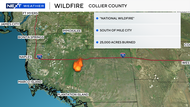
Although we no longer are under a red flag warning, there is still an enhanced fire risk due to the low relative humidity, dry conditions and the ongoing drought.
The CBS News Miami NEXT Weather Team is monitoring the National Wildfire in Collier County, located south of Mile City.
It has burned about 25,000 acres and is 0% contained.
The National Weather Service reported that smoke from the fire could spread, reduce visibility and lower the air quality along Alligator Alley and across parts of South Florida.
Hazardous beach and boating conditions will continue Tuesday. There is a dangerous high risk of rip currents along the Atlantic beaches on Tuesday. A small craft advisory is in effect for the Atlantic waters and Keys waters.
CBS News Miami 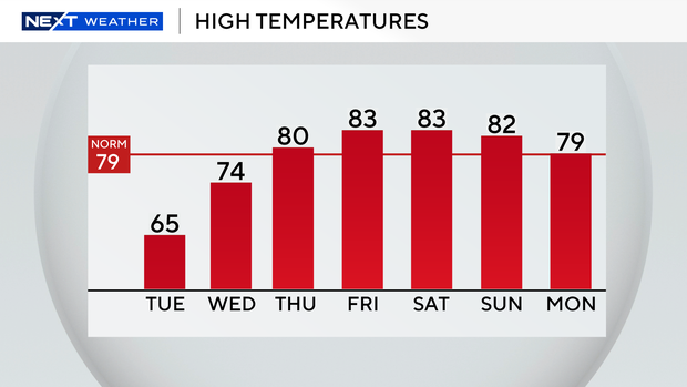
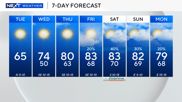
The high temperature on Tuesday will stay cool in the mid-60s under mostly sunny skies.
On Wednesday morning we will still be chilly with the low temperatures in the 50s and upper 40s.
CBS News Miami 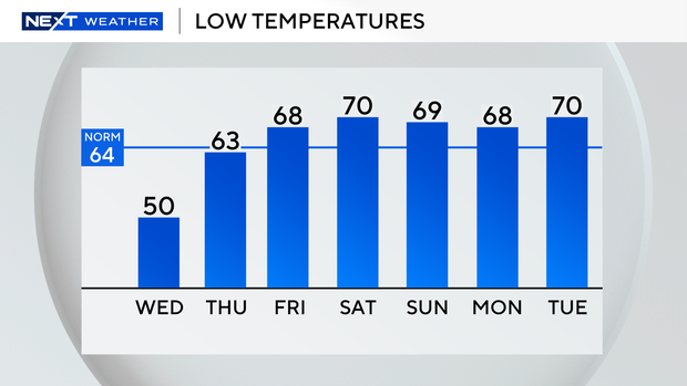
High temperatures will climb to about 70 degrees.
We’ll then be warming up later in the week as high temperatures rise into the low 80s on Thursday and Friday.
Much-needed rain returns this weekend as moisture moves in leading to scattered showers on Saturday and Sunday.
CBS News Miami