The 2025 Atlantic hurricane season ended on Sunday, Nov. 30. It was a season marked, for the United States at least, with a large gap between intensity and impact.
No hurricane made landfall in the U.S. this season — the first time this has happened in a decade. The season was also marked with periods that saw little to no activity, even as we approached the peak of the season in early September. These were only to be followed by bursts of intense activity, which generated powerful storms that intensified rapidly.
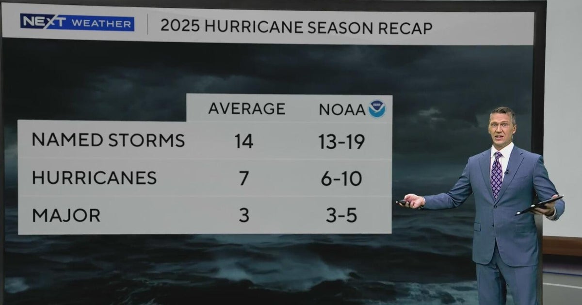
The season overall came in on the lower end of the forecasted range. There were 13 named storms and 5 hurricanes, of which 4 were major hurricanes. An average season has 14 named storms, 7 hurricanes and 3 major hurricanes.
The season kicked off with 3 back-to-back tropical storms
The season started with three tropical storms that formed from late June through early July. Tropical storms Andrea, Barry and Chantal, all developed between June 23 and July 7. Chantal was the only storm to make landfall in the U.S. early Sunday morning, July 6, in Litchfield Beach, South Carolina.
After Chantal, there were no storms for almost a month before tropical storm Dexter formed in the North Atlantic on August 3rd.
“We typically get a few early-season tropical storms before these large plumes of Saharan dust move off of Africa and over the main development region in the Atlantic,” said Next Weather Meteorologist Dave Warren. “This typically can lead to little to no activity through late July and even up through early August.”
The dog days of summer bring forth Erin
2025 was no different this year, but that all changed on Aug. 9, as a tropical wave coming off of Africa showed signs of slow development as it moved through this lingering dry air. On Aug. 15, conditions improved, and the storm was classified as Hurricane Erin.
Just one day later, Erin intensified rapidly, ranking fifth-fastest for the 24-hour increase in wind speed and third-largest pressure drop in 25 hours.
Even though the storm stayed off the East Coast, it still brought storm surge and tropical storm conditions to the North Carolina Outer Banks. Rip currents and rough surf were reported along the East Coast.
Two major hurricanes form in the autumn
From mid-September through October 1, the season saw two more major hurricanes: Gabrielle, a Category 4 storm with peak winds of 140 mph that stayed over the Eastern Atlantic, while Humberto became the second Category 5 storm of the season. Both of these storms showed a similar path to Erin, a turn to the north and eventually the northeast well before it reached the U.S. coast.
While the atmosphere was favorable for these intense storms and rapid intensification, the weather patterns continued to steer these intense storms away from the U.S. coast. This general movement would continue for what would become the third category 5 hurricane of the season, unfortunately, that turn north would take it right over the island of Jamaica.
Major Hurricane Melissa forms late October
Melissa became a tropical storm on Oct. 21 over the warm waters of the central Caribbean Sea. There was little to move the storm initially and it crawled west before conditions became favorable for development on Oct. 25.
On Oct. 27, the storm had wind speeds of 185 mph and a central pressure of 892 mb when it was about 45 miles southwest of Jamaica. It would go on to become the most powerful storm at landfall, tying hurricane Dorian in 2019 and the Labor Day Hurricane of 1935.
After Melissa, 2025 ends quietly
After Melissa dissipated in the North Atlantic on Oct. 31, the Atlantic saw no more activity for the remainder of the season.
Cold fronts started to sweep down across the eastern U.S., further reinforcing the steering pattern that would keep any potential storms off the U.S. coast.
The gap between intensity and impact may have grown this year for those living in the U.S., but the weather patterns that led to that may not be there in future seasons. What remains is the fact that many storms continue to rapidly intensify. Of the five hurricanes this year, four of them were major and three of them were Category 5 storms.
This fact will likely remain with future seasons, while the steering currents may not always be as favorable as they were this year.


