
The NEXT Weather Team is tracking the potential for scattered showers and isolated storms to close out the weekend and kick off the beginning of the upcoming workweek.
CBS News Miami
After a pleasant and dry Saturday across South Florida, rain chances return with about a 30 to 40 percent chance for rain. Most of the activity in the morning will be focused in the Keys, but showers and storms could push further north into Miami-Dade and Broward counties from the late morning through the early afternoon. A few isolated storms could develop within these showers and contain lightning and strong wind. Temperatures will start in the upper 70s and climb to the mid to upper 80s Sunday afternoon.
CBS News Miami 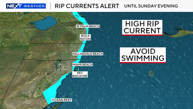
Slightly breezy conditions will also continue for today and keep our rip current risk high along the coastline. Minor coastal flooding for the Keys, Miami-Dade, and Broward counties will also be possible around 2 hours on either side of high tide, which is at 7:58 a.m. This is due to the combination of wind and the lunar cycle.
CBS News Miami 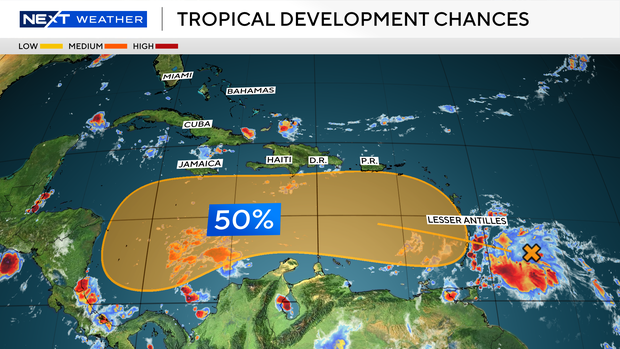
We are also monitoring a tropical wave just east of the Lesser Antilles. It continues to move west toward the Caribbean and has a 50% chance of tropical development next week. There are no direct impacts expected for South Florida from this area as of now, but our team will continue to monitor closely over the week.


