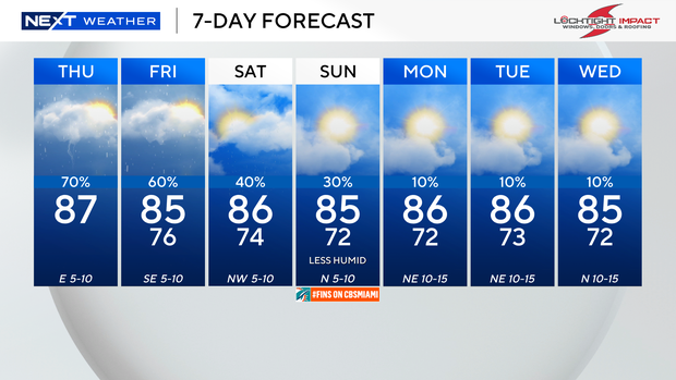
Rain chances increase Thursday through Friday with scattered to widespread showers and storms possible.
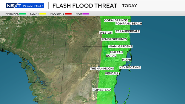
The Weather Prediction Center has put Broward and Miami-Dade under a level 1 risk of flash flooding since heavy downpours and localized flooding will be possible. Some showers moved in this morning and more storms are expected this afternoon into the evening. Highs will climb to the mid to upper 80s this afternoon.
The coastal flood advisory continues through this evening due to the higher-than-normal king tides. Saltwater flooding will be possible along the vulnerable, low-lying coastal areas during high tide times.
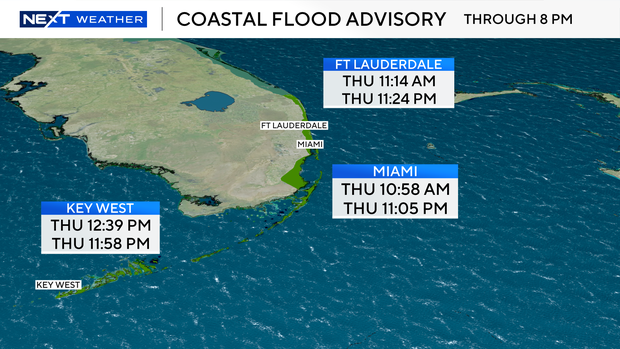
The next high tide in Ft. Lauderdale will take place at 11:14 a.m. and then at 11:24 p.m. The next high tide in Miami will take place at 10:58 a.m. and then at 11:05 p.m. tonight. The next high tide in Key West will take place at 12:39 p.m. and then at 11:58 p.m.
There is a moderate risk of rip currents along the Atlantic beaches. There are no alerts or advisories for boaters along the Atlantic or Keys waters.
The chance of rain stays high on Friday as deep tropical moisture remains in place. Scattered showers and storms will develop on and off again throughout the day with the potential for heavy rain in spots.
This weekend, a fall front will usher in drier air and lower rain chances. Although some showers will be possible early Saturday, there will be more sunshine and drier weather Saturday and Sunday. The humidity will also be lower.
Overnight lows will drop to the low 70s and it will feel more comfortable. Mother Nature will give us a little taste of fall with highs in the mid-80s. The chance of rain is even lower early to the middle of next week as the rainy season ends and the dry season begins on Oct. 15.