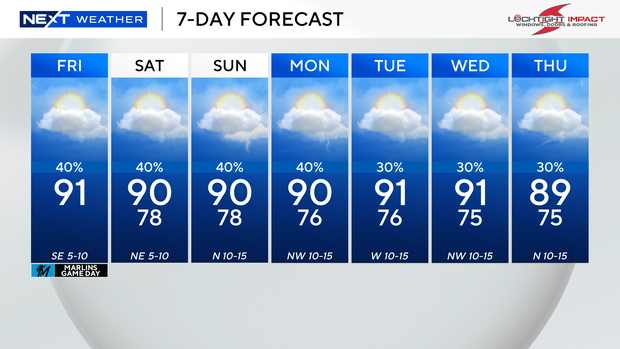
Friday morning was mostly quiet across South Florida but later in the day, scattered storms will develop.
Highs will climb to the low 90s by this afternoon and it will “feel-like” the upper 90s and 100s, factoring in the humidity.
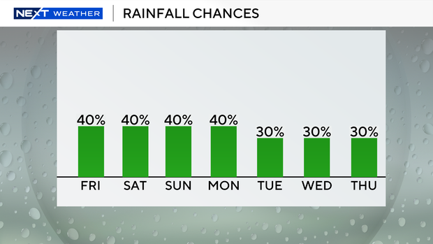
For now, the forecast calls for passing storms through the weekend, though the tropical wave in the Caribbean may bring indirect impacts to South Florida. This tropical disturbance is bringing heavy rain and gusty winds to Hispaniola and is becoming better organized.
The National Hurricane Center is giving this tropical wave a high potential of becoming a tropical depression or tropical storm as early as later today. The next name on the list of Atlantic names is Imelda.
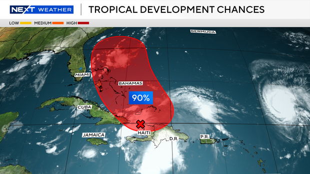
An area of low pressure is expected to form along the wave by tonight when it moves near the southeast Bahamas. This low is expected to become a tropical depression when it is near the central and northwest Bahamas over the weekend, and then track northwestward or northward over the southwestern Atlantic.
Most of the forecast models indicate this system will likely stay east of Florida due to a dip in the jet stream. Since it will be so close, we will need to closely watch this system since any slight change could determine whether we see outer rain bands and some squalls in South Florida.
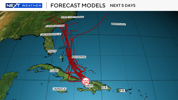
If it stays farther to the east, the rain chance will not be as high over the weekend but if it moves closer to the Florida coast, we may see more wet weather around. Early next week this system is expected to possibly move towards the southeast coast of the U.S. hence residents in Georgia and the Carolinas will remain on high alert.
Although this is the first weekend of fall, it will still feel like summer as highs will soar to 90 degrees and it will “feel-like” the upper 90s and triple-digits with a 40% chance of showers and storms. The chance of rain will decrease early to mid-next week.