The NEXT Weather Team is tracking a quiet start to Wednesday, but scattered showers and storms are possible later in the day.
Stray showers closer to the coast will be possible for the morning, but midday and afternoon showers and storms are expected to develop further inland. Similar to what happened on Tuesday, some of these showers and storms could push further east throughout the afternoon and impact the metro areas between noon and 4 p.m.
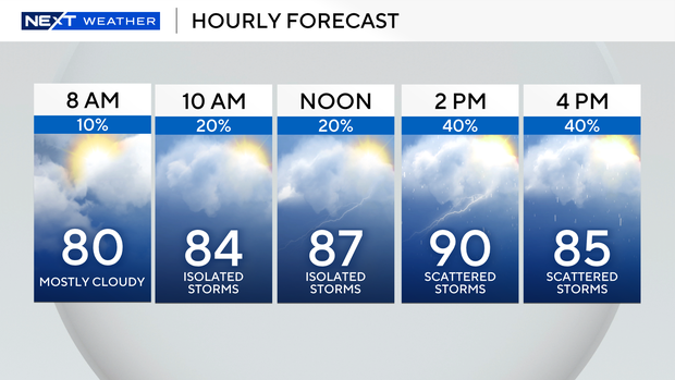
Rain chances will lower Wednesday evening.
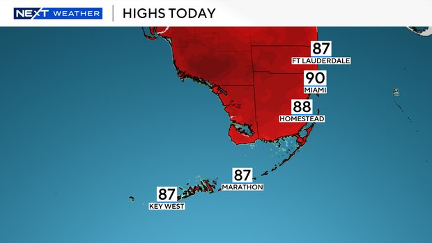
Seasonable temperatures in the mid to upper 70s start the day, but will climb to the upper 80s for the afternoon. Some isolated locations could reach 90 degrees. Regardless, “feels-like” temperatures will be closer to the upper 90s and lower triple digits.
Daily scattered showers and storms will continue for the workweek as afternoon highs hover around 90 degrees.
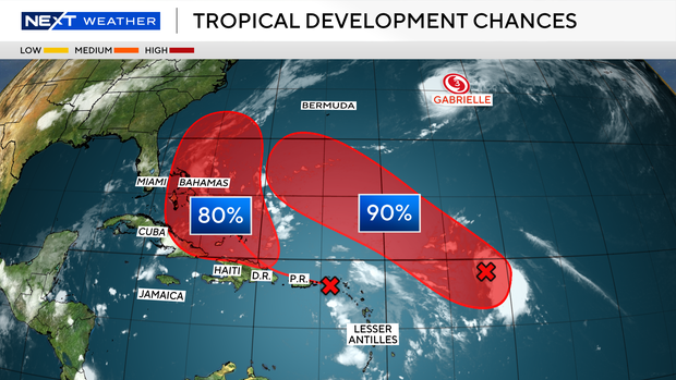
The NEXT Weather Team is also continuing to monitor two tropical waves in the tropics, both of which have a high chance of tropical development over the next several days. While no direct impacts are expected for South Florida at this time, tropical wind and rain will be possible for Puerto Rico, the Dominican Republic and Virgin Islands Wednesday.
Both areas of potential development are expected to remain east of Florida, but the NEXT Weather Team will continue to monitor closely over the coming days. The next named system will be called Humberto.