
Tropical Storm Fernand formed in the Atlantic Ocean southeast of Bermuda, forecasters said Saturday, becoming the sixth named storm of the 2025 Atlantic hurricane season.
With Fernand forming in a similar area to Hurricane Erin, which rapidly intensified into a Category 5 storm after forming last week, many in South Florida and the U.S. East Coast may be asking whether there will be impacts.
CBS News Miami 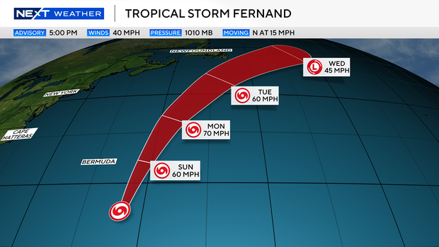
According to the National Hurricane Center, Fernand is forecasted to remain over the open ocean.
The NEXT Weather team reports that the storm will not pose a threat to land and is expected to last only a few days before it is forecasted to move over cooler waters in the North Atlantic.
Fernand is over warm water in the Atlantic and in an area with little-to-no wind shear for the next 48 hours, the NEXT Weather team said.
CBS News Miami 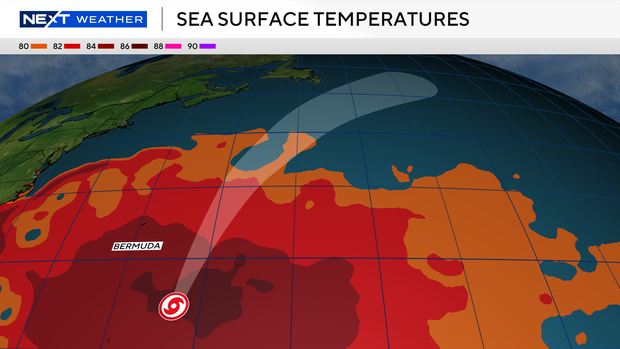
The NEXT Weather team and NHC said the forecast calls for Fernand to intensify and possibly become a minimal hurricane sometime Monday as it passes well east of Bermuda.
There are no watches or warnings for the storm as it is expected to turn northeast and remain south of Nova Scotia and Newfoundland
Nicole Brown Chau and
contributed to this report.


