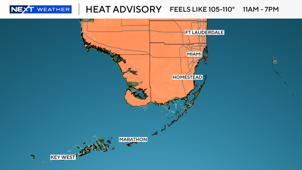
The National Weather Service has issued another heat advisory for Wednesday for Broward and Miami-Dade from 11 a.m. until 7 p.m. due to feels-like temperatures forecasted to reach 105 to 110 degrees.
This marks the 7th consecutive day of heat advisories.
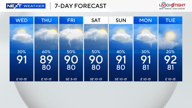
Wednesday morning starts warm and muggy with temperatures in the low to mid-80s. Highs soar to the low 90s again by afternoon. The chance of rain is not high, but some showers and spotty storms will be possible.
The bulk of the activity will be steered toward the interior and the Gulf Coast late Wednesday afternoon into the evening.
There is a low risk of rip currents along the Atlantic beaches, and the UV index is extreme. There are no alerts or advisories for boaters along the Atlantic waters or the Keys waters.
The chance of rain increases tomorrow with the potential for more widespread showers and storms due to more tropical moisture around. Heavy downpours, lightning and gusty winds will be possible. It will not be quite as hot as highs will climb to the upper 80s.
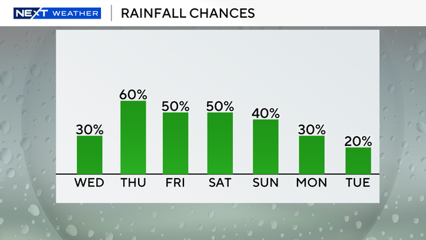
The atmosphere stays juicy and unsettled Friday into Saturday with the potential for scattered showers and storms. Highs will be closer to normal, around 90 degrees, and it will feel like the triple-digits.
Passing storms will still be possible on Sunday, but the chance of rain will start to decrease early next week as kids head back to school.