
Scattered showers and a few storms, some with heavy downpours, moved across parts of South Florida on Thursday morning. It was a warmer start to the day with temperatures in the low to mid 80s, it felt like the low to mid 90s when the humidity was factored in.
The chance of rain will be higher for the first half of the day. In the afternoon, the rain will be steered toward the inland areas and the West Coast due to an onshore breeze.
Highs will climb to the low 90s in the afternoon and it will feel like the upper 90s and 100s when you factor in the humidity.
NEXT Weather 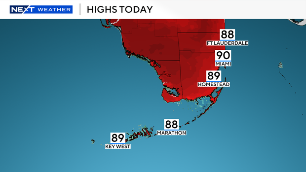
There is a moderate risk of rip currents along the Atlantic beaches and the UV index is extreme. There are no alerts or advisories for boaters along the Atlantic and Florida Keys waters.
Sizzling heat over the weekend
Unseasonably strong high pressure will bring hotter and drier conditions to South Florida beginning Friday and it will last through the weekend. With drier air in place, the chance of rain will stay low on Friday, Saturday and Sunday.
It will be sizzling with highs soaring to the low 90s. Dangerous heat indices in the triple-digits will be possible. The National Weather Service says it may issue its first heat advisory of the season.
Residents in South Florida are encouraged to take the necessary precautions to avoid heat exhaustion and heat illness. Stay hydrated, drink plenty of water, stay in the shade or AC during the afternoon hours or take frequent breaks if you need to be outside over the next few days.
Tracking the tropics
The CBS Miami NEXT Weather team is tracking an area of low pressure over the northern Gulf which now has a low potential (30% chance) of developing over the next seven days. Regardless of development, this system is expected to bring heavy rain and the potential for flash flooding along the north-central Gulf coast through Friday.


