
The month of July is kicking off with a wet and unsettled weather pattern.
Tuesday morning, a few showers moved across parts of South Florida. Throughout the day scattered storms will be possible as the wind shifts out of the south. Afternoon highs will climb to 90 degrees and but it will feel like the mid to upper 90s when the humidity is factored in.
The chance of rain remains high on Wednesday and Thursday as the southerly wind will continue to steer showers and storms across South Florida. It will stay seasonably hot with highs near 90 degrees.
Late week we’ll be closely watching a disturbance near northern Florida. The National Hurricane Center has increased the potential for tropical cyclone development to 30% over the next seven days. Although the development potential remains low, this system could bring heavy rain to the Sunshine State.
NEXT Weather 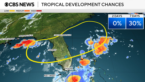
A low pressure system is expected to develop along a frontal boundary that will stall out across northern Florida. There is still uncertainty regarding whether this area of low pressure will develop in the Gulf and move west or develop in the Atlantic and head east. The forecast models are showing the potential for plenty of wet weather this upcoming Fourth of July holiday weekend.


