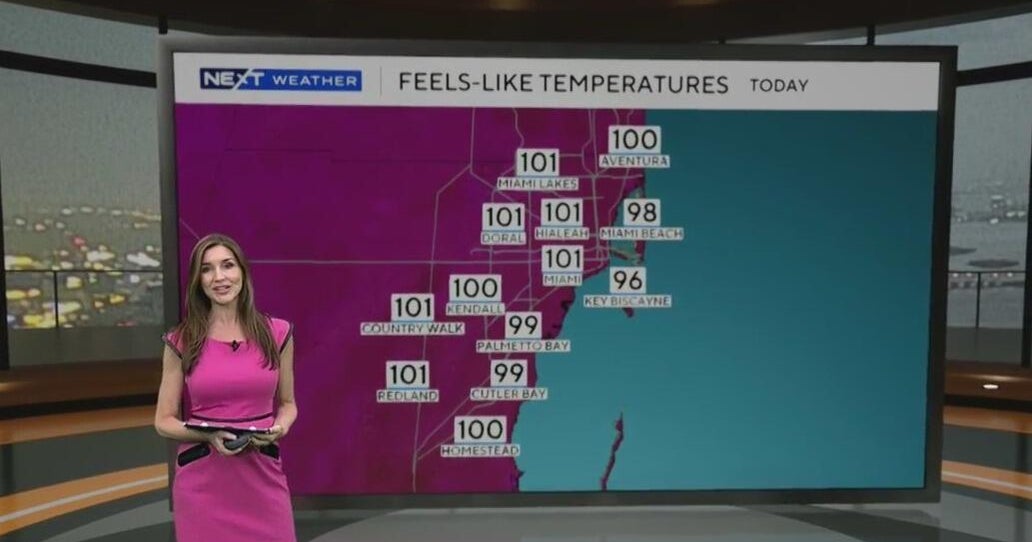
This is the final weekend of July and it’s going to be a scorcher.
Afternoon highs will be in the low 90s, but the “feels like” temperatures will be in the low triple-digits. Make sure to stay hydrated and try to stay in air conditioned places when possible to avoid heat exhaustion and heat illness.
Friday got off to a warm, steamy start with temperatures in the low to mid 80s and heat indices in the 90s.
A few showers will be possible on Friday as the breeze builds out of the southeast, but the chance of rain is low due to drier air and Saharan dust moving in. It will be hazy at times due to the dust. Those with respiratory conditions are urged to limit their time outside as the air quality is moderate for most of South Florida.
There is a high risk of rip currents along South Florida’s beaches due to the strong onshore breeze. It is not safe to go swimming in the ocean. The UV index is extreme so don’t forget the sunblock. There are no alerts or advisories for boaters along the Atlantic waters. Small craft caution should exercise caution over the Keys’ waters as it will turn choppy near shore.
The sweltering heat sticks around on Saturday and Sunday as high pressure dominates the weather pattern. Highs will soar to the low 90s and it will feel like the 100s. The National Weather Service may issue heat advisories due to dangerous heat indices.
Early next week the chance of rain will increase a bit with the potential for spotty showers Monday through Wednesday. Highs remain in the low 90s.
Disturbance brings rain to the north-central Gulf
In the tropics, the National Hurricane Center is monitoring a broad area of low pressure over the north-central Gulf which is currently producing an area of disorganized showers and thunderstorms. There is a low potential (10% chance) of development while this disturbance moves generally west-northwestward across the northern Gulf. By the weekend, the system is likely to move inland over southeastern Texas or western Louisiana, ending its chances for development. Regardless of development, locally heavy rainfall is possible for portions of the northern Gulf coast through the weekend.


