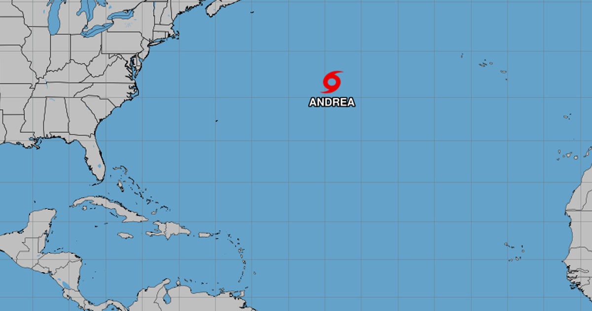
Tropical Storm Andrea formed in the central Atlantic Ocean Tuesday morning, becoming the first named storm of the 2025 Atlantic hurricane season.
As of 11 a.m. Eastern time, Andrea was located about 1,205 miles west of the Azores, with maximum sustained winds of 40 mph and higher gusts. The storm was moving east-northeast at 17 mph and was not expected to threaten any land areas.
No coastal watches or warnings are in effect.
NEXT Weather meteorologist Shane Hinton said it will be very short lived as it continues to stay in the central Atlantic.
The National Hurricane Center said Andrea is unlikely to strengthen and is expected to begin weakening Tuesday night. The system is projected to dissipate by Wednesday night.
The average date for the first named tropical system in the Atlantic is June 20, according to the NEXT weather team.
NOAA 2025 Atlantic hurricane season forecast
In May, the National Oceanic and Atmospheric said there’s a 60% chance that this year will be an “above-normal” hurricane season, with between 13 to 19 named storms. Six to 10 of those are expected to strengthen into hurricanes, and three to five could become major hurricanes, forecasters said.
They estimated there’s a 30% chance of a “near-normal” season and a 10% chance of a “below-normal” season.
An average season produces 14 named storms, including seven that develop into hurricanes. Three of those, on average, become major hurricanes, meaning a Category 3 or higher on the Saffir-Simpson scale, with sustained wind speeds of at least 111 miles per hour. Category 5, the top of the scale, brings wind speeds of at least 157 mph.


