
Grab your umbrella before you head out the door, we’re in for a wet Wednesday.
An upper level low with deep moisture is moving through causing widespread showers and lighting in the morning hours.
The bulk of the afternoon and evening showers will continue along the Gulf coast.
On Thursday the surface flow will begin to weaken which will slow down the sea-breeze storms and impact the eastern metro before activity pushes inland later in the afternoon and evening.
NEXT Weather ![]()
A NEXT Weather Alert has been issued for Thursday and Friday.
NEXT Weather Chief Meteorologist Ivan Cabrera said with the deeper atmospheric moisture, a localized heavy rain threat may materialize across urban areas if persistent heavy rainfall occurs.
NEXT Weather 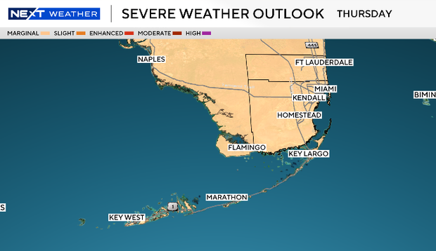
The Storm Prediction Center has placed all of South Florida under a “marginal” (Level 1) risk for strong storms and damaging winds on Thursday and Friday.
On Thursday, the most active period for the storms will be from noon to 5 p.m. On Friday, the most active period will be from 1 p.m. to 5 p.m.
The upper low pulls away Friday and into the weekend which will lower the chance or rain.
High temperatures will remain in the upper 80s with feels-like temperatures in the mid to upper 90s


