South Florida will warm up the next few days ahead of the next cold front moving in midweek.
It’s a milder start to Monday morning, with lows in the upper 60s and low 70s across South Florida. This afternoon will be dry and sunny with highs close to normal in the low 80s. The breeze will build out of the east with gusts as high as 15 to 20 mph.
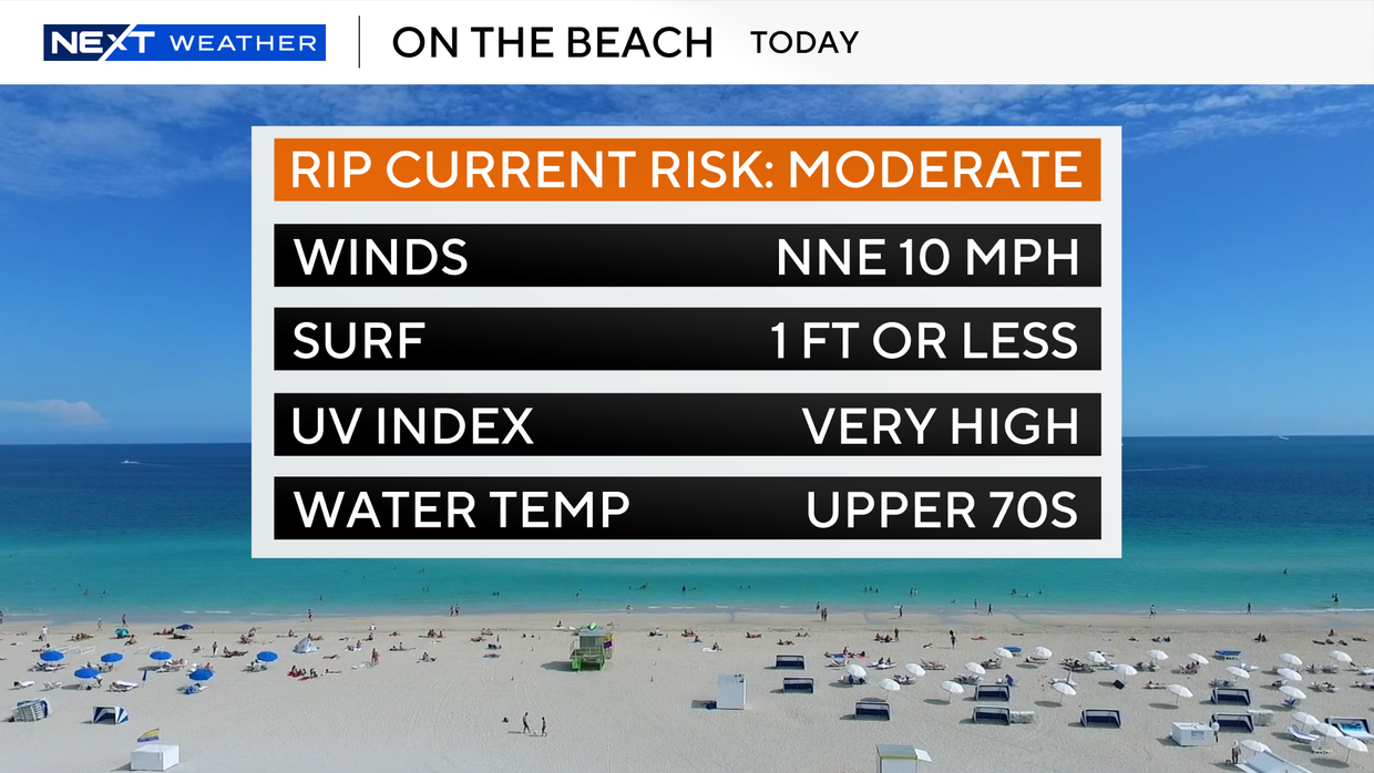
There is a moderate risk of rip currents along the Atlantic beaches due to the strong onshore breeze. There are no alerts or advisories for boaters over the Atlantic waters or Keys waters.
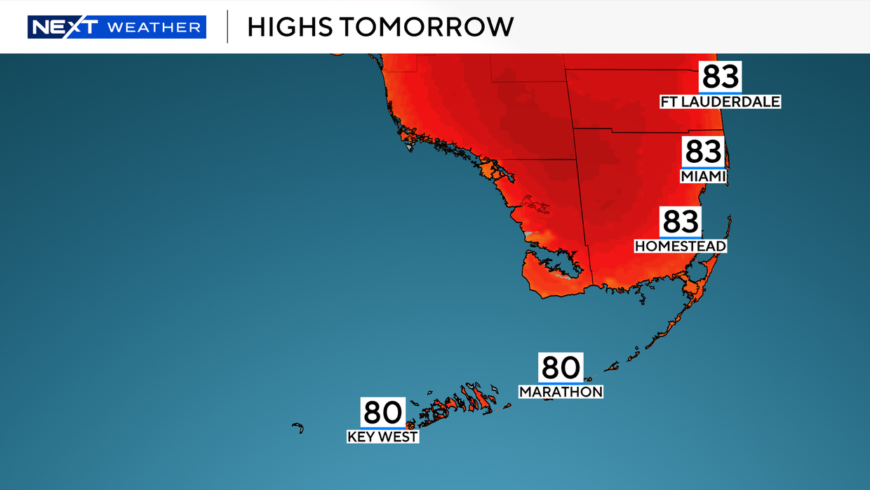
Tuesday morning will be comfortable, with lows in the upper 60s and low 70s. Highs will rise to the low 80s in the afternoon under mostly sunny skies.
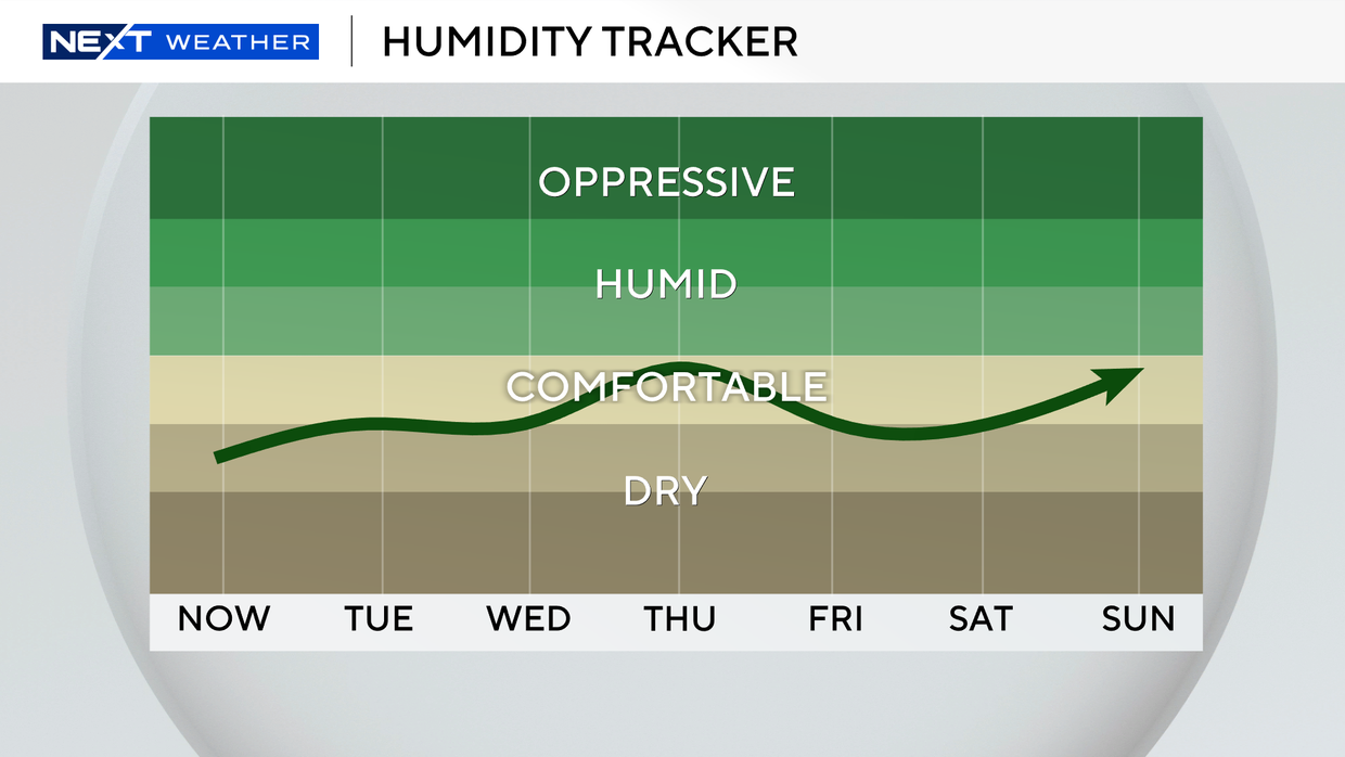
Wednesday will be warmer, with highs near the mid-80s. Although this next front will not bring a drastic drop in temperatures, it will usher in drier air and lower humidity. Temperatures will not be as warm in the afternoons, with low 80s.
High pressure will keep South Florida quiet and mainly dry through late week. Lows will be mild, in the upper 60s and low 70s. Highs climb to the low 80s. The chance of rain stays low on Saturday. For Easter Sunday, isolated showers will be possible as highs will remain in the low 80s.