
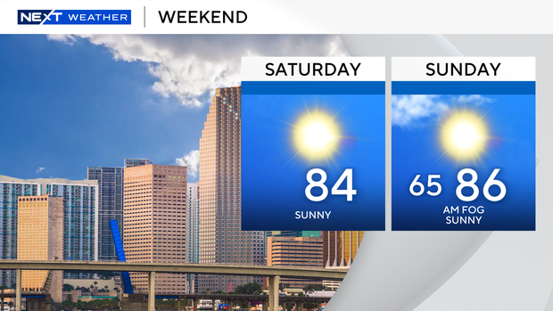
After the coolest morning since January on Friday, we kick off a significant warming trend Saturday. High temperatures will warm into the middle 80s across the coast with some upper 80s inland under a cloud-free sky today.
Dry, clear conditions will continue into this evening.
By tomorrow morning, some fog development is looking likely, especially for our inland areas. Once the fog lifts out by mid-morning, we’ll enjoy another day of full sunshine Sunday.
Temperatures will be even warmer, with highs set to warm into the middle to upper 80s across the coast. We may touch 90 degrees for some inland areas for this first time this year by tomorrow afternoon.
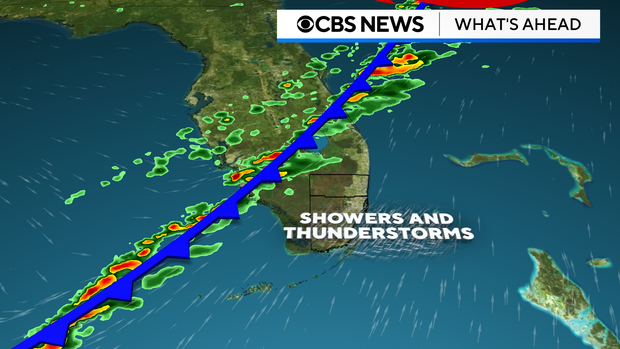
The warm-up comes ahead of a cold front that will move through around midday Monday. Out ahead of it, Monday will be windy and warm before a broken line of showers and storms moves in from 1pm to 5pm Monday.
Due to the fast-moving and broken nature of this line of storms, rainfall amounts will likely stay under a quarter of an inch for those areas that do receive.
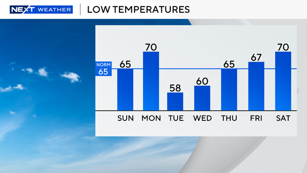
Behind the front, cooler and drier air will move in once again for Tuesday. In fact, jackets will be needed again for Tuesday morning with morning temperatures expected to fall into the middle and upper 50s.


