
MIAMI – We’re in for a windy day across South Florida as Hurricane Rafael approaches from the south.
While the worst of Rafael will remain far to the west of the lower part of the state, South Florida, particularly the Keys, will still experience some lower magnitude fringe impacts beginning Wednesday afternoon. They’ll persist into the evening and early Thursday morning.
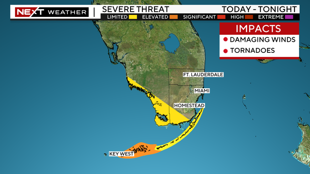
NEXT Weather
By late Wednesday, the outer bands of Rafael will move into parts of the lower and middle Keys where a tropical storm warning remains in effect.
These bands will continue to move through the Keys on Wednesday night into early Thursday morning. Within these bands, we’ll have to watch for tropical downpours, gusty to damaging winds, and the threat of isolated tornadoes. In fact, the lower Keys is under a level 2 out of 5 risk for severe weather.
Improvements will begin Thursday afternoon as Rafael moves away from South Florida. Winds will begin to lighten and rain will begin to exit, leaving us drier for Friday and Saturday.


