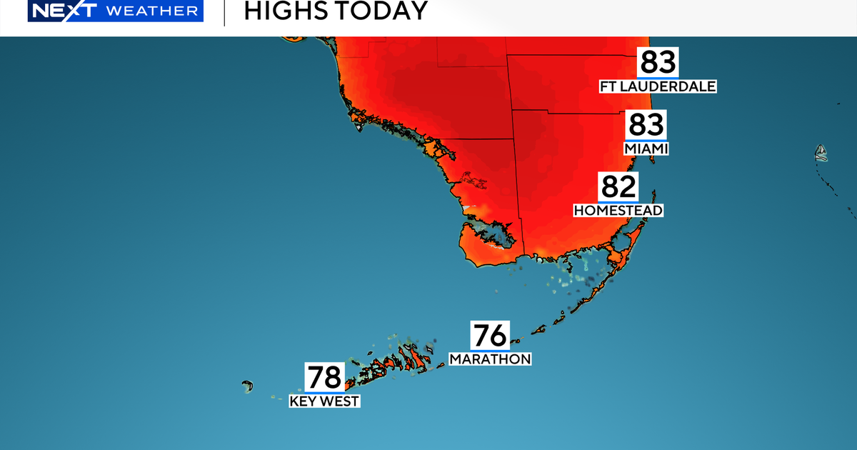
MIAMI (CBSMiami) – It was a quiet and dry start to Wednesday but later in the afternoon and evening storms will develop again and some could turn strong to severe.
Before the rain rolls in, we will warm up to the mid-80s this afternoon with a mix of sun and clouds. The heating of the day along with plenty of moisture will lead to an unstable atmosphere and help fuel thunderstorms later in the day.
READ MORE: CBS Reality Show “Beyond The Edge” Features Most Difficult Celeb Survival Challenge Ever
Based on current forecast models, the storms will likely fire up around 2 p.m. or 3 p.m. and may become more intense and widespread late afternoon and evening.
The Storm Prediction Center has placed Broward and much of Miami-Dade at a marginal risk of severe storms with the potential for heavy rain, localized flooding, gusty winds, and lightning. There is a slight chance of hail and an isolated tornado cannot be ruled out.
READ MORE: Charges To Be Dropped Against Man Accused Of Threatening To Burn Down School Over Mask Mandate
Wednesday night a few storms will be possible.
On Thursday, St. Patrick’s Day, we still have the potential for spotty showers and storms in the afternoon and evening but the rain chance will not be as high.
The rain chance will be even lower by Friday as we settle into a drier and more tranquil weather pattern to start the weekend. However, Mother Nature is turning up the heat and we’ll enjoy more sunshine, highs will soar to the upper 80s on Friday and Saturday.
MORE NEWS: Kyiv Couple Spend Three Weeks In Laundry Room, Refusing To Leave Ukraine
On Sunday some breezy showers will return when we officially kick off Spring with the vernal equinox.


